KANSAS CITY, MISSOURI, US — California has had an amazing start to the new year with torrential rainfall and impressive mountain snowfall easing long-term drought. The implications of improved precipitation are tremendous with fruit and vegetable production in the state to improve, especially if there will be follow-up precipitation in February. However, the recent events in California have caught the eye of long-range weather forecasters because of a pattern that could be repeated during the spring and summer in other areas across North America.
Long-range forecasters always are looking for help when trying to predict the ultimate fate of the spring and summer seasons. This year’s weather could be challenging for forecasters once again because of conflicting weather patterns and the abating La Niña phenomenon.
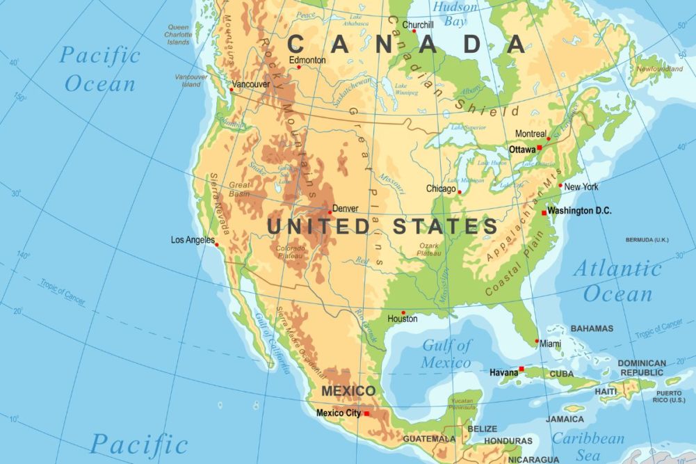
Early season guesses for spring and summer across North America include a potential for below-average precipitation in a part of Canada’s Prairies and the northern US Plains during the spring and a potential for below-average precipitation in the Midwest, and areas southward to the Gulf of Mexico coast states. Summer should be wetter, but not necessarily in the central or southern Plains or in a part of the western Corn Belt.
There is already a prevailing weather pattern that has suggested lighter-than-usual precipitation will occur this spring from the Gulf of Mexico coast states to the Great Lakes region. Only once in six times that this pattern has appeared has there not been a lighter-than-usual precipitation bias. That is a great statistic, but it leaves the door open to debate over whether the five years of below-normal precipitation was just coincidental or a real pattern that can be used in long-range forecasting. Be careful here, the lighter-than-usual March through May precipitation is not a drought pattern and it should follow an active late winter weather pattern that should have soil moisture adequate for spring planting. The lighter-than-usual precipitation could lead to a fast planting pace without serious concern about soil and crop conditions — at least not until late spring and summer.
California’s recent wet bias may help add confidence to the spring and summer outlooks because of an apparent strong relationship between greater-than-usual December and January precipitation in northern California and other anomalies that occur later in the year. World Weather, Inc. found 15 instances of notably wetter-than-usual December and January years in California’s Climate Division Two since 1900.
The period March through May of the same January that was wetter than usual had a below-normal precipitation bias from the northern half of the Delta through the Ohio River Basin and to a lesser degree of correlation in Missouri, Kansas, Nebraska, Iowa and immediate neighboring areas to the north. The Pacific Northwest tended to be drier biased as well as a part of the southeastern states and New England. Wetter-than-usual weather occurred in southern Texas, southern Louisiana and in a part of the southern Rocky Mountains and along the lower California coast.
The most significant part of the below-normal precipitation bias noted above was for the lower Midwest and northern Delta. The California connection to the spring outlook presents the same below-normal precipitation bias in March through May that already was suggested by other atmospheric weather patterns. This trend adds greater confidence for the lighter-than-usual spring precipitation.
The California connection also suggested a well associated greater-than-usual summer precipitation bias in the US Pacific Northwest and in a part of the northwestern Plains and southwestern Canada’s Prairies during June through August. To make matters a little more interesting for the summer of 2023, this same connection to California’s wet December/January period also promoted a drier-than-usual summer in central and eastern Texas, the Delta and areas north into Kansas and southern Missouri.
There was also a lighter-than-usual summer rainfall pattern from Iowa and parts of Nebraska into Michigan and northern Ohio as well as New York and New England. The precipitation anomalies for both spring and summer are a little dry and may be raising a little more concern about production in 2023 even though La Niña is going away.
World Weather, Inc. was not comfortable at using just one climate division from California for this study so a larger portion of Northern California was then studied and helped reduce the number of years that fit the “significantly” wetter bias requirement for December and January to just six years. The results led to a spring season that was drier than usual in the northern Plains, Canada’s southern Prairies, the US Midwest and Delta and an expansion of wetter-biased summer weather from the Pacific Northwest into a larger part of the northern Plains and northern Midwest. This latter scenario also suggested below-normal summer precipitation from southern Kansas to southern Texas and east through the southeastern states and again in New York and New England.
All of these associations may appear to be a little confusing, but rest assured there is a high level of consistency in the lighter-than-usual spring precipitation bias in the Midwest and Delta with some potential for dryness in the northern US Plains and southern Canada’s Prairies as well. If these anomalies evolve as suggested, concern over summer dryness likely will rise, especially in the southern half of the Plains, the Delta and a part of the lower Midwest.
There is potential for improved rainfall in the northern Plains, southern Canada’s Prairies and possibly the upper Midwest during summer, especially in July and August, which might bring relief after spring’s lighter-than-usual precipitation bias. However, having both spring and summer a little drier than usual in the Delta, lower Midwest and possibly the southern Plains will raise some concern about 2023 production and it certainly raises the needs for a closer watch on evolving weather trends this spring.
One final note of interest includes the persistence of strongly negative Pacific Decadal Oscillation that is prevailing today and has been for 18 months. If the pattern prevails, it, too, will support a wetter bias in the northwestern and north-central states this summer while drier biases prevail in central and southern Plains, Delta and southwestern Midwest. Summer 2023 is not necessarily going to be a better year just because La Niña goes away.


