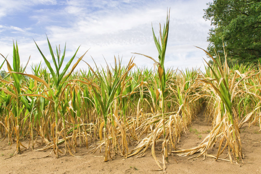
KANSAS CITY, MISSOURI, US — Dryness has returned to Mato Grosso, Brazil, just in time to hurt Safrinha corn yields during reproduction. The moisture stress that was becoming more widespread in the state at the end of April will be closely monitored for about three weeks. In the meantime, the market focus is quickly shifting back to North America where there is much talk about weather adversity.
The Brazilian situation is not good. The area impacted is mostly Mato Grosso and Goias, but they collectively represent a large portion of the anticipated second season crop this year. Dryness during the reproduction is never a good thing and yields are sliding lower. A little more than half of the corn crop was reproducing at the end of April and the remaining crop was expected to reproduce in the first half of May.
Topsoil moisture was rated very short in many areas at the end of April while subsoil moisture was rated marginally adequate to short. Crop stress was present and increasing in the last 10 days of April, but production cuts could still be minimized by generalized showers and thunderstorms. There is potential for some precipitation, but monsoonal rains have ended for the season, leaving mid-latitude frontal systems as the only method for bringing rain to the region.
Argentina does have potential to be colder than usual in May and that could send a cold airmass into southern Brazil and a frontal system into Mato Grosso, Mato Grosso do Sul, Parana and Goias. Such a frontal system would bring rainfall to the area and could reverse the declining yield trend.
However, there were no strong frontal systems expected through the first 10 days of May. The longer it takes to get moisture into the Safrinha corn and cotton areas of Mato Grosso, the more yield loss is possible. Most pollination already will be complete by the third week in May, and if significant rain has not occurred by that time, most of the second season corn will come up with reduced yields. Some analysts already have reduced the crop and more cutting is expected through the first half of the month.
Problems looming for North America
North America is the next big production area in the world that is vulnerable to adverse weather in 2022 and any problems there, especially in the United States, could create food shortages and send market prices even higher.
North America weather problems already have evolved. Southwestern Canada’s wheat and canola region is still much too dry while excessive April precipitation from North Dakota to Manitoba, Canada, has stopped most farmers from entering their fields. The situation is unlikely to improve enough for fieldwork until possibly the middle of May.
Farther to the south in the US Midwest, Delta and Tennessee River Basin, spring planting of rice and corn has been delayed by too much rain and cooler-than-usual temperatures. The wet-biased environment was peaking in the first week of May with little to no progress occurring in many areas, but there is still time for improved weather and successful planting. In the meantime, US hard red winter wheat areas are suffering from all kinds of adverse weather and production is expected to be cut.
Similar to this time last year, drought is present from northern Mexico through most of the west half of the United States and into the southwestern Canadian Prairies. The drought has been driven by a unique combination of weather patterns all reinforcing one and another.
La Niña has prevailed for 21 months and any time that phenomenon prevails this long there is potential for drought in North America and possibly in a part of Central Asia. La Niña’s persistent presence at this time in the 22-year solar cycle often is involved with multi-year droughts and this drought has been around since 2020. Having a persistent La Niña in the 22-year solar cycle while the Pacific Decadal Oscillation (PDO) is negative (meaning colder-than-usual ocean water off the West Coast of North America and warm water farther to the west) leads into strong summer ridge building in the central United States and that can extend north into Canada.
In the past when all three of these significant weather influences have occurred at the same time and with significant intensity, the result was almost always drought for the US Plains and a part of the Midwest. Weather patterns do not always have to have the same solution, but this combination of weather features has a nasty reputation of negatively impacting agriculture and production.
Delayed planting in the western Corn Belt because of a wet start to spring followed by dryness during the summer would not bode well for 2022 production, and until there is a trend change that pulls the plug on this environment the assumption is that at least a portion of the United States is going to come up short on production. The debate is on about determining production losses, but it is still too soon to have much confidence in any of this since crops are not in the ground yet.
La Niña’s impact
Changes in weather influences are underway that raise the potential for changes in North America, especially in Canada’s dry region. La Niña is peaking in its intensity and should begin weakening in May. That weakening trend will continue into June. While this is happening, the lingering effects of stratospheric warming that took place in March, causing cold weather in North America during April, also is abating.
The reduction of influence from these events raises the potential for change in North America. However, the change will be led by the negative phase of PDO, which promises to put a quasi-permanent trough of low pressure along or over the western parts of North America.
Putting a trough of low pressure aloft over western North America forces a relocation of the autumn, winter and early spring high-pressure ridge from western North America to central parts of the continent. This relocation program for high pressure aloft will bring an end to the recent wetter biased weather in the US Plains and western Corn Belt, although the change in weather will not be completed until late May.
Meanwhile, while the US Plains and western Corn Belt are trending drier and warmer because of the high-pressure ridge aloft, there also will be a change in Canada. Most of Canada’s southwestern Prairies that have been drier than usual for years will have the potential for relief as storm systems coming into the northwestern United States should move northeasterly into the Prairies, resulting in frequent July and August rainfall. Some of the rainfall improvement will occur in June. The improved rainfall in Canada should come in time to save many crops that were planted in dry soil during the spring and were expected to struggle with dryness until June when rain starts more routinely.
Problems with South America weather and crop production are about over, but there is a relatively good chance that problems in North America, particularly the United States, may be just beginning and could extend our food inflation issues out possibly another year.
Drew Lerner is senior agricultural meteorologist with World Weather, Inc. He may be reached at worldweather@bizkc.rr.com. World Weather, Inc. forecasts and comments pertaining to present, past and future weather conditions included in this report constitute the corporation’s judgment as of the date of this report and are subject to change without notice.


