KANSAS CITY, MISSOURI, US — A ridge of high pressure evolved recently over the heart of Russia’s grain production region grabbing some attention in the commodity trade. Ridges of high pressure aloft over Russia tend to occur in years of El Niño to La Niña transition. Sometimes a similar ridge of high pressure evolves over the central United States impacting the Great Plains, western Corn and Soybean Belt and the southeastern Canada Prairies with drier and warmer-than-usual weather.
Producers and traders who are looking for a market rally are watching these two regions closely.
A more significant influence on the market trade is likely to be world demand for grain and oilseeds and that seems to be lacking in recent months. South America production this year will ensure that the market supply of grain and oilseeds is sufficient for an average demand year.
The biggest question regarding this year’s commodity futures prices has to be in the combined influence of agricultural product demand and any production pressure that might evolve. Most of the weather around the world has not been adverse enough to throw market trade into a tizzy, which is why the speculation over summer crop development in the United States, Canada and Russia may be the only potential trigger for at least a short-term market weather rally.
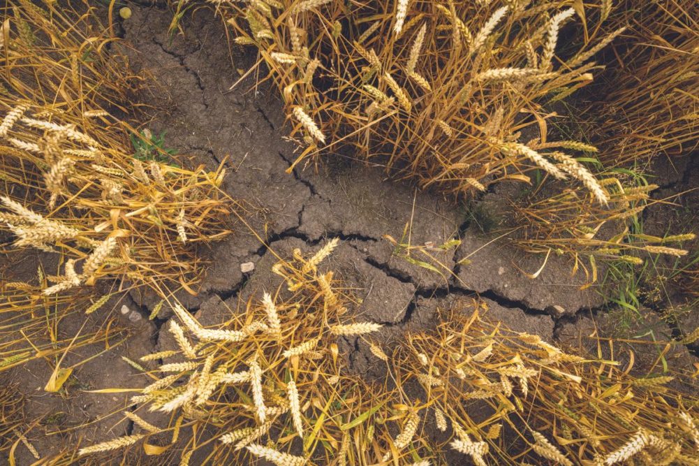
Russia’s Southern region, eastern Ukraine and Kazakhstan have just completed more than six weeks of below-normal precipitation and the second half of that period was also warmer than usual. So far, though, that warm and dry bias has been mostly good for spring planting and for more aggressive winter crop development.
A breakdown in that ridge of high pressure was expected for a little while in late April and early May. That may allow some rain to fall, but the dominating influence on weather patterns in Russia should return the high-pressure ridge later in May and June when temperatures will be much warmer, and the ground will dry quicker.
The return of dry and warm weather later this spring and early summer is anticipated, and its impact will be closely monitored. Recent years of similarity produced a variety of impacts on production with 2010 being the most extreme and 2016 having the least impact. Also, 1988 was a year of interest because of dryness that affected North America at the same time.
Canada’s Prairies have been dealing with drought for a few years with some areas in the southwestern parts of the region reporting drier-than-usual conditions for more than seven years. The impact on summer crop production has been most significant since 2020. Recent weather in Canada’s Prairies has shown signs of a breakdown in the persistent dry pattern. Late spring rainfall is expected to be greatest in the eastern Prairies while the west remains drought stricken. However, during the summer these trends likely will reverse with more rain in the west and less rain in the east, which will reduce the potential for another drought year in the Prairies, even though drought continues today.
US weather has trended in a pattern that supports a dry and warm late spring and early summer, but a rainy weather pattern that dominated the eastern Midwest in March and early April has the soil in those areas plenty wet. More recently, there has been a trend change shifting the greatest rainfall into the western corn and soybean production areas. Drought is being whittled down in Iowa and neighboring states, and this was expected to continue through the first part of May.
The same weather pattern that changes Canada’s weather this summer also will change the US weather, and that will include a ridge of high pressure over the Great Plains and western Corn Belt. The high-pressure ridge is not expected to be of great magnitude for a long period of time, but perhaps long enough to deplete soil moisture and induce a few bouts of hot weather.
There is a considerable amount of support for the drier and warmer-biased weather over several weeks this late spring and mostly during the summer in the central United States. The lunar cycle coupled with La Niña and the negative phase of Pacific Decadal oscillation all point toward a period of warmer and drier-biased weather. It is too soon to accurately predict the outcome of all these negative influences, but the current bout of rainy weather is of great interest.
Rainy weather in the United States has been delaying some farming activity and that process will continue into the second half of May. The wet bias will do two things. First, it will further delay planting, and if the delays become significant and are followed by a period of hot, dry, weather, late planted crops may be doomed to be more stressed than usual. The moisture abundance recently has increased soil moisture so that there is greater humidity during the summer and that could help hold the temperatures back for a while and support some feedback thunderstorms that erupt in the Plains and western Corn Belt.
The moisture in the Midwest is a feature that must be closely monitored, but there is also some cooling occurring in the ocean off the West Coast of the United States and in the Gulf of Mexico. If these trends prevail too long, they could help contribute to warmer and drier weather during the summer.
More recently, the rainfall pattern this spring has looked much like that of years in which El Niño evolves into La Niña. The anomalies from the past show a tendency for the Gulf of Mexico Coast States (east of Texas) to be wetter than usual as is the region from Missouri to Wisconsin and Illinois. That coincides very well with what has happened in the recent past in years of quick transition from El Niño to La Niña. Those same spring seasons that were wetter biased in the heart of the Midwest, Delta and parts of the southeastern states trended notably drier and warmer biased just a few weeks later. Negative PDO and the lunar cycle could certainly reinforce this pattern.
So, despite today’s market doldrums there is potential that US and Russia weather will be threatening enough to at least induce a short-term market rally. The rest of the potential will lie in agricultural commodity demand.
Drew Lerner is senior agricultural meteorologist with World Weather, Inc. He may be reached at [email protected]. World Weather, Inc. forecasts and comments pertaining to present, past and future weather conditions included in this report constitute the corporation’s judgment as of the date of this report and are subject to change without notice.