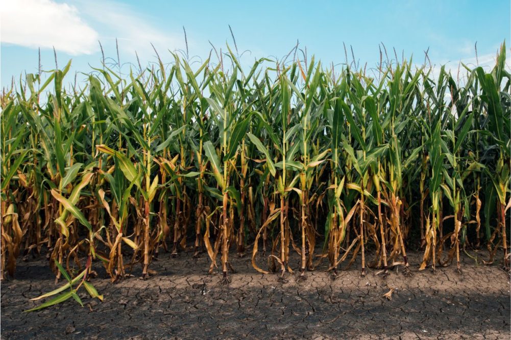
KANSAS CITY, MISSOURI, US – Three months of below-normal rainfall in the Midwestern US has created the driest crop year since 2012. Vegetative Indices have suggested general crop conditions across the Midwest have been worse than those in 2012, but with corn pollination just getting underway in some areas there is potential that early July rain could save some of the crop from the same fate of that year. Soybeans have a better chance of recovering since its most moisture-sensitive period won’t occur until later this summer.
World Weather, Inc. does not believe the losses to production have reached those of 2012 — at least not yet. This year’s weather has not been nearly as hot as that in 2012, and that likely has bought the crop a little time. The most significant precipitation deficiencies have occurred from eastern Missouri and southeastern Iowa into the heart of Illinois and western Indiana. Portions of Michigan and random areas across Wisconsin and Minnesota also have reported less than 1 inch of moisture since the last days in May. Some counties in central Illinois and Michigan have reported no more than a half-inch.
The most important part of the assessment on crops this year can be seen in the rainfall accumulation charts. Rain in the Dakotas, southwestern and far northwestern Minnesota, many areas in Iowa and parts of the region from eastern Nebraska into eastern Kansas and western Missouri received 2 inches to more than 5 inches of rain during the month of June. Some similar amounts were noted in Ohio and Kentucky with 1 to 3-inch amounts in eastern Indiana. The moisture in these areas has protected crops from huge production cuts, but poor weather in April, May and early June has not left these wetter areas with their full production potential. Nonetheless, in 2012 dryness like that noted above in the central Midwest was more widespread and it was hot.
The production game is obviously not over, but there is hope that US corn production cuts will be tempered by the somewhat limited extent of the driest conditions and by the absence of extreme heat. The first half of July will still have much to say about corn production and any increased rainfall could stop the fall in production and put a cap on the losses while improving soybean development potentials.
Arrival of El Niño
So, why has all of this happened? World Weather, Inc. believes it is all about the multi-year La Niña event that abated early this year and the quick development into El Niño while in this particular solar cycle and with colder-than-usual ocean surface water temperatures off the West Coast of North America. The abating La Niña disrupted spring weather patterns in such a way to block Gulf of Mexico moisture from flowing northward through the Midwest. That alone accounts for a huge part of the dryness problem that is present in the Midwest today.
Late June atmospheric conditions were hinting that changes were going to evolve during July opening the Gulf of Mexico as a moisture source once again. There were also signs that the delayed southwest monsoon in Mexico and the southwestern United States was going to finally evolve in July. These two moisture sources usually help provide moisture in key Midwestern and Great Plains crop production areas. Without these sources of moisture this year’s drought likely would turn into another 2012 sized event, but that should not be the case.
The southwest monsoon moisture usually streams northward from Mexico into the southern and central Rocky Mountain region while impacting a part of southeastern Arizona and New Mexico. The moisture gets far enough north to merge with mid-latitude frontal systems moving through the central and northern Plains and when that merger occurs, the frontal systems pull the moisture from the Rocky Mountains into the central and/or northern Plains and into the Midwest resulting in greater rainfall. When the Gulf of Mexico is open as a moisture source to the Midwest, a south to southeast wind will carry large volumes of warm, moist, air from the Gulf of Mexico into the Midwest and sometimes as far north as Canada. The combined impact of moisture from the Gulf of Mexico and the monsoon moisture can help induce drought-reducing rain to the Midwest, but like everything else in life, it is all about timing.
The two moisture feeds must begin immediately to provide sufficient relief to Midwest dryness in time to stop corn yields from falling further and to bolster soybean development. There is concern that the timing of increased rainfall will come too late for some of the corn crop. Late reproducing corn and soybeans have the best potential of seeing improved yield potentials if the rainfall increases as advertised. The increase is supposed to occur slowly in July with none of the 3 to 9-inch moisture deficits in the Midwest going away in the first half of the month. Timely rain will occur to stop the decline in crop conditions and yield potential.
The best rains are not expected until August, although some increasing precipitation frequency and amounts may begin in July. The evidence for this comes largely from the parallels seen in the years 2005, 1987 and 1969 and in 1965 and 1972. These five years all had some similar weather trends, most of which led to an absence of hot weather and the development of late-season rainfall.
Lastly, the development of El Niño in itself can bring improving rainfall to the western half of the Midwest Corn and Soybean Belt as the summer moves along while below-average precipitation tends to prevail in the eastern most portions of the region. World Weather, Inc. is not convinced how well the rainfall will be distributed later this summer, but the opening of the Gulf of Mexico and monsoon moisture from the southwestern states should provide “opportunity” for relief at that point.
Drew Lerner is senior agricultural meteorologist with World Weather, Inc. He may be reached at [email protected]. World Weather, Inc. forecasts and comments pertaining to present, past and future weather conditions included in this report constitute the corporation’s judgment as of the date of this report and are subject to change without notice.