KANSAS CITY, MISSOURI, US — Years of atmospheric study are on the line in 2022. Decades of experience, predictions and failures and lessons learned have convinced this meteorologist that the atmosphere is a chaotic mess up close, but when you step back it is rhythmic and a little more orderly than one might believe.
The phrase “we are living in interesting times” seems to fit well socially, economically and even atmospherically today. Multiple weather patterns are lining up with the same signal, raising deeper concerns that North America’s drought will advance to the east this summer while allowing wetter conditions back into Canada and the northern US Plains.
If nothing else has been learned in the past four decades, meteorologists and climatologists have discovered that the oceans play a huge role in planet earth’s weather. Of course, ENSO (El Niño/Southern Oscillation) events, La Niña and El Niño, are completely driven by ocean surface temperature anomalies in the equatorial region of the Pacific Ocean.
There are a number of other ocean-related oscillations that exist, but the one that is playing out this year along with La Niña is Pacific Decadal Oscillation (PDO). The northeastern and north-Pacific Ocean surface temperatures are anomalous in such a way that cool water is present off the West Coast of North America while warmer-than-usual water exists across the north-central Pacific. This phenomenon is called the negative phase of PDO and that usually results in a higher potential for a trough of low pressure to evolve along or over the West Coast of the United States, especially during the warm season.
The negative PDO, when strong enough, can produce cooler-biased conditions in the western United States during the spring and summer seasons and support a strong ridge of high pressure in the middle of the nation.
There is a PDO index that is used to determine the significance of the anomalous temperatures in the Pacific Ocean and in the fourth quarter of 2021 that index was as strongly negative as it was in the 1950s. The negative PDO index has been seen multiple times in the past, but there are certain times in weather history in which the presence of strongly negative PDO and a multi-year La Niña event can work together to produce notable dryness in the middle of North America, and this year may be one of those times.
The times in which these features have come together to reinforce the dry bias seem to occur between the solar minimum and solar maximum in the sunspot cycle. Sunspots have been monitored for hundreds of years, and they are well correlated with some anomalous weather around the world.
One of those highly ranked correlations is with drought in the middle of North America and in parts of Russia during the period between the solar minimum and the solar maximum, which is usually a five-year period, and it is normally associated with a La Niña event relatively close to the solar minimum. That La Niña event tends to last many times longer in every other solar cycle, which is normally 10 to 12 years in length.
Since multi-year La Niña is most common to every other 11-year solar cycle, that cycle is referred to as a 22-year solar cycle instead of the 11-year cycle.
What will La Niña do?
This year (2022) is in that 22-year solar cycle, and the minimum of sunspots was recorded in 2020 and La Niña began in that same year and has prevailed 19 months with a brief two-month pause last summer. Most La Niña events in this 22-year solar cycle have lasted 23 to 36 months, and that helps add some support for computer forecast models predicting La Niña will continue through spring and possibly into summer this year. If that occurs while PDO is still significantly negative, the potential for drought in the central United States becomes much greater because that is what has happened in the past when these three patterns work together.
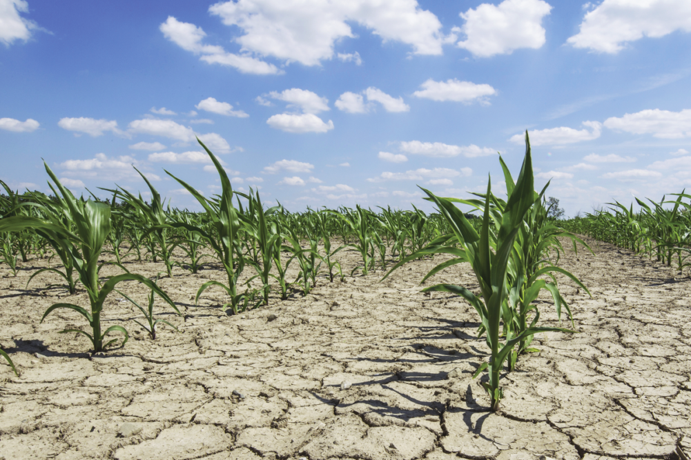
La Niña creates a dry bias in the central and southwestern Plains in the winter, and if it is allowed to prevail through spring it will perpetuate that dryness into summer and allow it to expand into the western US corn and soybean production areas.
La Niña events in this cycle also tend to dry out the southeastern United States while keeping the southwestern states, including central and southern California, drier biased as well. As the warm season unfolds and the jet stream in North America weakens and shifts farther to the north, the dry bias in the Plains continues to be influenced by dry weather, not only because of La Niña but due to the negative PDO as well. PDO will have much to say about the positioning for this year’s spring and summer ridge of high pressure in North America, but with La Niña already drying out the US central and southwestern Plains and possibly the western Corn Belt, the potential for ridge building will be greatest over the already dry areas in the central US.
Once the ridge of high pressure establishes, it (and the trough of low pressure in the western US) will support rainy weather from the northern Rocky Mountain region into Canada’s Prairies and a part of the northern US Plains while the central and southern Plains, western Corn Belt and parts of the Mississippi River Basin trend drier and warmer than usual.
A correlation study showing this relationship puts it all into perspective. In the fourth quarter of 2021, the PDO index was strongly negative. Correlations between strongly negative PDO in the fourth quarter of any year and drought in the central United States is moderately high.
The correlation is also high between below-normal precipitation and the strongly negative fourth quarter PDO index for the eastern Midwest.
The implications of this are that 1) drought has a high potential of prevailing in the Plains and western Corn Belt this summer and 2) below-average precipitation is likely in the eastern Midwest during the same period. It is important to also note that while La Niña and negative PDO promote dryness in the central US in the post 22-year solar minimum years, they also promote wet-biased weather in the winter and spring across the northern Delta, the lower and eastern Midwest and a part of the Tennessee River Basin.
The wet winter and spring in the eastern Midwest and northern Delta should delay planting. Once crops get planted, they will reproduce later than usual, and that is when the highly correlated negative PDO suggests dryness will evolve during June, July and August. That implies a tough summer in the Plains and western Corn Belt because of drought and a tough growing season in the eastern Midwest and Delta because of a wet spring and then a drier summer.
It is all about cycles, but a meteorologist with 43 years of experience only gets to see this pattern twice in his/her lifetime, which takes all of their knowledge and experience and puts it on the line for a rare time such as this when these patterns co-exist. Past weather performance is no guarantee of the future, but after all, these are interesting times.


