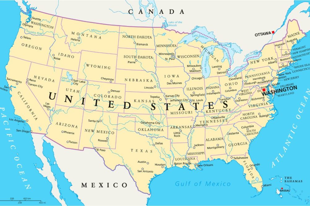
KANSAS CITY, MISSOURI, US — Drought continues to plague portions of North America. Some of the driest areas are in Canada’s central and southwestern Prairies and neighboring areas of the northwestern US Plains, the central and southern Great Plains and much of the Great Basin and California. A big part of the Midwest is still drought free, but the region will need to be closely monitored this autumn and winter because there appears to be a dry bias for the March through May period in 2023.
Most of the world’s weather has been caught up in a multi-year La Niña event the past two years and it looks like portions of the world will see it prevail into at least the beginning of a third year. The phenomenon has been strongly linked to the 22-year solar cycle, and despite some media pronouncements that these conditions are unprecedented they are quite cyclical.
The longer La Niña prevails the more moisture is removed from the middle latitudes. Dryness in Europe, North America and China is all related to this phenomenon as has the South America multi-year drought. Persistent La Niña events also produce an abundance of moisture in the tropics and subtropics. Just as this pattern repeats there are many others that do the same and how they all interact with one another determines weather conditions from one season to another.
World Weather, Inc. has found another interesting pattern of repletion with spring seasons that may show itself again in the spring of 2023. This particular pattern is unrelated to the recent solar cycle and La Niña phenomena, but because it will follow the recent years of La Niña there is some potential that the atmosphere will not properly recharge with moisture in the US Midwest and Delta raising the potential for a dry spring.
History has shown that some of the more serious droughts in the Midwest have evolved after below-average spring precipitation. That is not necessarily going to occur in the summer of 2023, but with world food stocks already low it might not be a good time for a new dryness problem.
The pattern anticipated in the spring has occurred six times since the start of the 20th century and five of the six times that it appeared rainfall during March through May was below normal from the US Great Lakes region into the Delta and interior southeastern states. Now before going much further in this discussion it is important to note that the data shows below-average precipitation in these spring seasons — not necessarily completely dry conditions.
That is important to keep in mind as is the fact that the Gulf of Mexico is a huge moisture source for the eastern United States and it is very difficult to shut off that moisture for an extended period of time, hence the few occurrences of serious, long-lasting, droughts in these areas. The western part of North America is much more prone to persistent long-term dryness than eastern areas so be careful not to read too much into the data we present here.
North America winter weather also will have a big role to play in the significance of below-normal precipitation in the Midwest and Delta during the spring of 2023. Dryness is already a big issue in the Plains and portions of the far western United States and in large portions of Canada’s Prairies. The autumn and early weeks of winter will be dominated by La Niña and that does not bode well for drought relief in the central or southwestern US Plains, the southwestern desert region (including central and southern California) or central portions of Canada’s Prairies.
La Niña should produce good rainfall in western Washington, western Oregon, northern California and along the front range of the Canadian Rocky Mountains. Some La Niña events restrict rainfall in the lower Delta, the southeastern states and a part of the western Corn Belt during the winter seasons. If this year’s La Niña prevails too long through the winter, spring may arrive with all of the areas noted above still lacking moisture. La Niña should dissipate during the winter, but if the repeating below-normal spring precipitation pattern kicks in quickly enough there might be potential for dryness to prevail and expand across parts of the Midwest, Delta and southeastern states.
When La Niña does begin to abate there will be potential for rain in portions of the far western states and the central and southwestern Plains. Interestingly, the same years of repeating below-average precipitation in the Midwest and Delta tend to generate greater-than-usual precipitation in the central and southwestern Plains and a part of the western Corn and Soybean Belt.
Winter 2022-23 is expected to be dominated by La Niña early, but with that phenomenon expected to dissipate during mid-season, the odds will turn favoring a strong northwesterly flow pattern in the eastern parts of North America. This pattern would bring frequent bouts of cold air into the eastern parts of North America and restricting precipitation from the northern Plains and eastern Canada’s Prairies into the Midwest.
That kind of weather pattern would easily lead into a below-average Midwest spring season. There might also be a potential for a high-pressure ridge to evolve in the western part of North America that will help warmer-than-usual temperatures spread through the western states and into a part of the Plains. All of this raises a certain level of interest for the spring of 2023.
No one likes a drought monger and this meteorologist is not touting drought (yet), but stranger things have happened. A close watch on winter precipitation is going to be required this year from Canada to Mexico and from the Pacific Coast to the Atlantic Coast. There are many potential precipitation and temperature solutions to all of this for the spring next year and the best way to get a handle on the correct solution is to pay close attention to La Niña and precipitation distributions throughout North America.
The same requirement for closely monitoring weather is warranted for South America through the next six months since La Niña’s presence raises some potential for dryness from eastern Argentina into southern Brazil and southern Paraguay again. How significant that may or may not be remains to be seen, but the next couple of weeks promise good rainfall across some of the areas in question.
Drought in Europe already is being eased and so is some of the dryness in Russia, but China’s Yangtze River Basin is still drought stricken as is Argentina. Relief is expected for most of these areas in the coming months, but how significant the relief will be can only be determined by watching short-term atmospheric trends.


