KANSAS CITY, MISSOURI, US — Rain and thunderstorms that scattered across Canada’s Prairies and the northern US Plains recently improved topsoil moisture and spurred on some improved crop development; however, the outlook for summer is still dry biased for many areas.
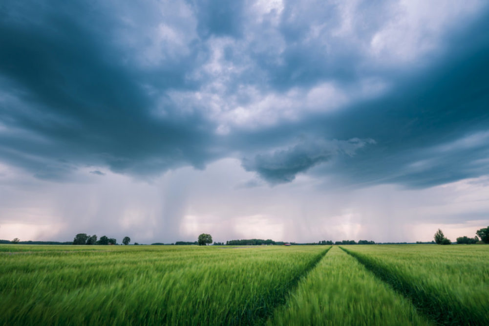
Recent rain was extremely important and very well-timed for grain, oilseeds, sugarbeets, dry beans and other crops produced in the northern US Plains and Canada’s Prairies. The relief was badly needed after several days of extremely dry and warm to hot weather. Temperatures in North Dakota during the first week of June peaked in the upper 90s to 106° F. The last time Bismarck, ND, reached that warm of a level was in 2015 when the highest reading was 104°. Extreme heat in the northern Plains rarely occurs unless drought is present. That was the case in 2012, 1988 and in the 1930s.
Are we comparing dryness in North America to the 1930s? No, but the point is that drought has been serious and the potential for recent rain in the northern Plains to represent the peak of this year’s drought is extremely low. A repeating weather pattern in the upper atmosphere coupled with a cool pool of ocean surface water off the West Coast of the United States and the lingering effects of the dissipated La Niña all point to more dry weather for the northern Plains, southeastern Canada’s Prairies and the upper US Midwest.
Rain reported recently in the Saskatchewan, Manitoba and portions of the northern Plains bolstered topsoil moisture and improved field conditions for a period of aggressive crop development. The rain was significant enough to prevent crop failure in some cases of extreme dryness, but frequent follow-up rain is needed to prevent some of these areas from falling back into a dry weather mode that would threaten crops when reproduction comes along. It is summer, but the traditionally hottest time of the year is still in front of us, and the odds are high that as soon as the jet stream weakens and slows down the high-pressure ridge will stagnate, leading to persistent weather, which may be dry and warm biased for these areas.
The dry bias in the northern Plains and Canada’s Prairies may not be limited to those areas, but could expand into a larger part of the US Midwest and Great Plains later this summer. There already has been a tendency for drying in the western Corn and Soybean Belt in recent weeks and this bias for lighter-than-usual precipitation should continue. As time moves along the drier bias will present some new concerns for a part of the western Corn Belt and Great Plains, but most of that should come along in July and August.
In the meantime, the lower eastern Midwest, Delta and southeastern states have been dealing with more routinely occurring rainfall and less heat. This trend may continue for a while. However, recent rainfall in the Delta was exceptionally great and flooding became an issue for the region once again. Drying is needed and should evolve soon enough to prevent serious crop consequences. With that said, however, a few crops in low lying areas may already have been negatively impacted by recent heavy rainfall. The last thing the Delta needs is a tropical cyclone, and forecasters will be watching the tropics over the next few weeks for any sign of tropical activity that would threaten the region.
As summer moves along, a trough of low pressure is expected to become a quasi-persistent feature in the eastern United States. The trough will lead to additional rain and thunderstorm activity in the southeastern states and the lower eastern Midwest. Temperatures also will be kept in check by the trough of low pressure with readings more seasonable to slightly cool at times. That will contrast with the warmer weather that is expected farther to the west.
There are not many other areas in the world that are vulnerable to a significant dryness issue over the next few weeks. Dryness in Brazil is continuing in the northern Safrinha corn production areas, but the crop is filling, maturing and beginning to be harvested, which should limit how much additional decline in yield can take place before harvesting is completed. Southern Safrinha crop areas in Brazil have had well-timed rainfall since reproduction ended helping some of the production from that area, but more than half of the crop was not included in that rain and suffered yield losses.
China’s weather has been and will continue to be mostly good for summer crop development. The same is true for Europe, although western parts of the continent will likely experience a slight warmer and drier bias in weather during the heart of summer. Crops in Eastern Europe and western portions of Russia, Ukraine and Belarus will experience a good mix of weather this summer.
India’s monsoon is beginning a little poorly for western crop areas in the nation and in particular away from the coast in Maharashtra, Gujarat, Karnataka, Tamil Nadu and Andhra Pradesh, but these areas will do better with rainfall a little later in the summer. The slow start to rainfall in June should not have a huge impact on production potentials, but cool ocean surface water temperatures in the Arabian Sea may keep rainfall a little light into at least the first half of July.
Australia’s wheat, barley and canola production areas have been planted under fair to very good conditions. Western Australia, Victoria and eastern crop areas in New South Wales have had the best distribution of planting moisture. Most other areas in the nation need more rain to get the crop off to a better start. South Australia, Queensland, northwestern Victoria and western New South Wales crop areas will need more rain later this month and in July to induce a better stand and to protect production potentials. World Weather, Inc. believes the timely rain will be there when needed most.
Argentina is the only other area in the world worth watching since its southwestern wheat production areas are running a little drier than usual. More rain will be needed in the next few weeks to support the best stand and ensure a good potential start into the spring season. Most of Argentina’s wheat region has greater soil moisture than either of the last two years and production potentials should be good in the spring, but only if improved rain comes in the next couple of months.